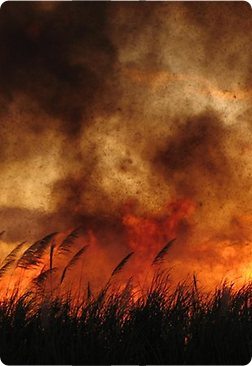
 Large areas of the Shire of Jerramungup are prone to bushfires due to topography, vegetation and climate. Effective from the 8th April 2016 the State Government has introduced the Bushfire Planning Reforms to help protect lives and property against the threat of bushfires throughout Western Australia. These reforms introduce new requirements for people intending to develop and/or build in bushfire prone areas, including the need to assess a property’s bushfire risk and take additional construction measures to limit the impact of bushfires.
The new bushfire planning requirements apply to all new planning proposals for habitable buildings (e.g. house, holiday accommodation, ancillary accommodation, etc.) or specified buildings in areas designated as bushfire prone on the Map of Bush Fire Prone Areas (unless exemptions apply). You can identify your property on the Map of Bush Fire Prone Areas by visiting the DFES website. If your property is located within a bushfire prone area according to this map, you may need to undertake a bushfire attack level (BAL) assessment.
Approval Process
All habitable development (i.e. houses including extensions & additions, ancillary accommodation and associated outbuildings) require assessment against the bushfire policy framework.
The first step is to check the state-wide mapping designating 'bushfire prone' areas. If any part of your property is designated 'bushfire prone' then:
(a) If in Bremer Bay or Jerramungup Townsite:
NB: An applicant may opt to lodge a planning application seeking to reduce the BAL rating even if the current rating is BAL 29 or less.
(b) If in the ‘Rural Residential’ zone in Point Henry:
(c) If in any other zone:
The BAL Assessment then informs the design response to the bushfire threat. Development requirements can include:
- Constructing in accordance with Australian Standard 3959 'Construction of buildings in bushfire prone areas'. A copy can be made available for viewing at the Shire office; and
- Compliant access, turnarounds for emergency service vehicles, water for fire fighting and 'Asset Protection Zones' (APZ). APZ are low fuel areas immediately around the house.
More Information
Very good information sheets and ‘Frequently Asked Questions’ pages provide more detailed information and are available on both the Department of Planning, Lands and Heritage and Building Commission websites.
Further Information
This information is intended as an overview of the current building and planning requirements in relation to building houses, ancillary dwellings and associated outbuildings in bushfire prone areas within the Shire of Jerramungup.
The Shire has prepared the following information packs and relevant policies/information:
Fire Control Information Notice
Variation Form
Defining Community Resilience
Potential Upgrading Measures for Existing Dwellings
Refer to the Shire's Point Henry Fire Management (page under construction) page for additional information.
DFES
Bushfire Publications
Department of Planning
Bushfire Planning Publications
Bushfire Planning Reform